Credits: NASA/JPL-Caltech/MSSS/Keven M.Gill
Source and license: https://flickr.com/photos/53460575@N03/54459073428
Additional question: On earth I’ve seen these layered structures as a result of sedimentation or deposition (horizontal) and then folding (vertical).
How do geologists explain these structures (and their change of orientation - if there was any) on Mars? Same (oceans and rivers) or a totally different idea?
I just want to make sure I understand what/how you’re seeing this, I hope you don’t mind:
When you say you’re seeing vertical structure, are you talking about those protruding (and rather phallic) parts in the upper half of the image?
EDITED TO ADD image with relevant features outlined in yellow:

Not quite. I mean those layers.I tried to mark the edges in the image.

Since we are looking at a wall, these layers are vertical. If they are layers. :)
I’m not a geologist, but as far as I can recall, I’ve not seen any studies from the rovers that have identified folding. Sedimentary rocks have been observed, were laid down in water, streams rivers, river deltas and and lake beds. In addition they have examined sandstone deposits that laid down in dryer times.
MSL team member used to maintain a great list of papers, but it’s not been updated for a while (budget cuts) You’ll find lots of them on the following link
Nothing about folding but a lot about sedimentary rocks. Thanks.:)
👍
What’s the orientation of the image here? Does the camera look down or forward?
The MAHLI camera can be pointed in many directions as it’s mounted on the turret at the end of the rover’s robotic arm. In this case it’s pointing pretty much straight down. Here’s a NavCam image of the robotic arm that was acquired when the MAHLI image was captured.
Thanks
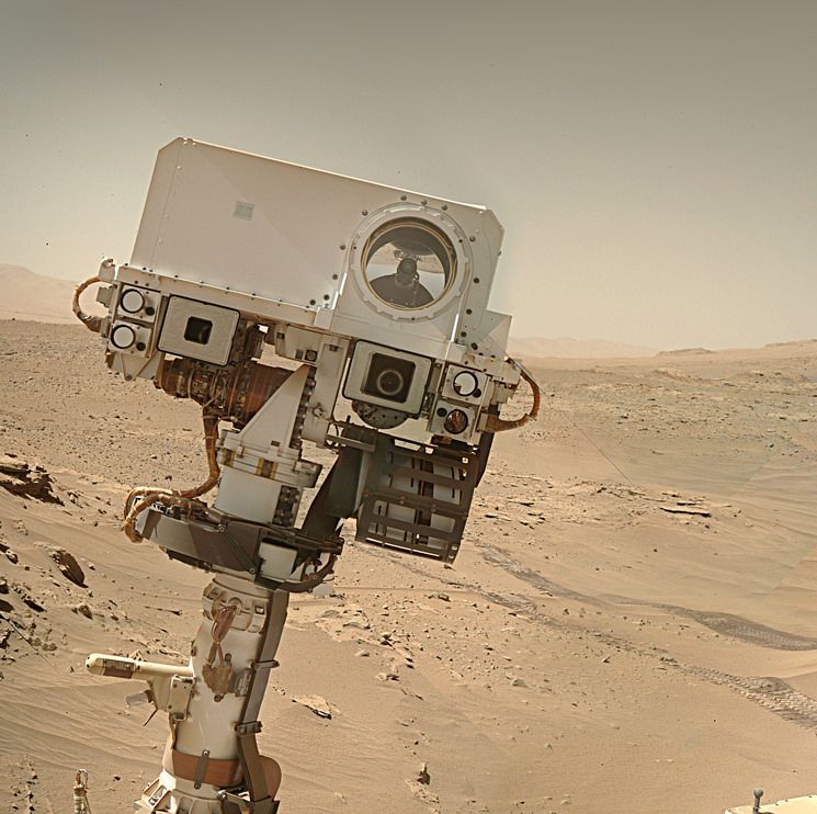
MAHLI camera on the robotic arm earlier in the mission


It looks forward.
Thanks