Unlike the human head, the earth actually is nearly spherical. There’s got to be some differences in how spherical projections work when the object actually is a sphere, I would think. I know that 2D maps are distorted, but are globes actually this distorted as well? Never knew that, if so.
Edit:
After reflecting on it for a minute, I see they’re demonstrating forms of 2D map distortion. The way depth is represented is variable. With modern concepts of 3D imagery, we must have solved this distortion problem. If you open up Google Earth’s globe, it doesn’t have such distortion.
With modern concepts of 3D imagery, we must have solved this distortion problem.
? You’re still taking a three dimensional earth and displaying it on a 2d screen or plane. That will always have distortion on some axes. That’s not a technological “problem” to be “solved”, that’s just mathematical reality.
Yes, that’s my point, we have computers that can pretty accurately represent depth, not like the old projections we drew on maps. Stretching it out flat (zooming in on google earth) has less distortion than these projections shown here, don’t they?


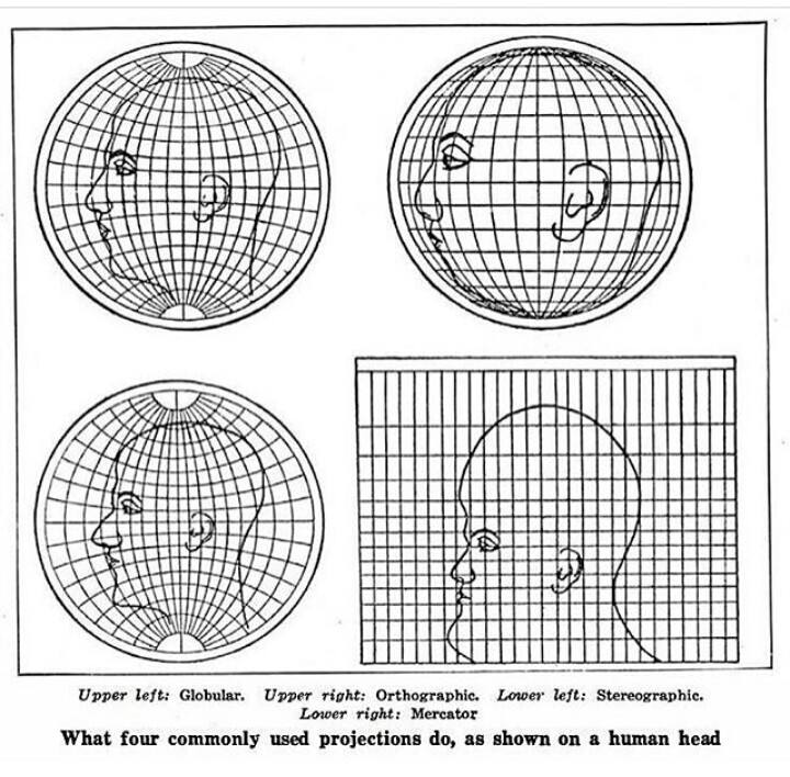
Unlike the human head, the earth actually is nearly spherical. There’s got to be some differences in how spherical projections work when the object actually is a sphere, I would think. I know that 2D maps are distorted, but are globes actually this distorted as well? Never knew that, if so.
Edit: After reflecting on it for a minute, I see they’re demonstrating forms of 2D map distortion. The way depth is represented is variable. With modern concepts of 3D imagery, we must have solved this distortion problem. If you open up Google Earth’s globe, it doesn’t have such distortion.
? You’re still taking a three dimensional earth and displaying it on a 2d screen or plane. That will always have distortion on some axes. That’s not a technological “problem” to be “solved”, that’s just mathematical reality.
Yes, that’s my point, we have computers that can pretty accurately represent depth, not like the old projections we drew on maps. Stretching it out flat (zooming in on google earth) has less distortion than these projections shown here, don’t they?